HARP: A high altitude balloon student project
High Altitude Recovery Payload
Tyler Weaver, Andre Pasechnyk, Mike Sheets, Kory Hill

Backgroud
High altitude balloons, also known as weather balloons, are large balloons filled with lighter than air gas that ascend, expanding as the air pressure degreases, until they finally burst. Scientists and hobbyists use these balloons to gather images and information about high altitudes at a low cost. Traditionally when the balloon bursts it returns to earth under a non-directional parachute. This often requires teams to travel many miles to track and recover their payloads.

Introduction
The tracking systems employed by these payloads use GPS units for position and altitude data. Based off the experience of the team members jumping from airplanes with directional parachutes, the HARP project aims to simplify recovery by guiding a directional parachute using the input from the GPS unit on the tracking system.

Design
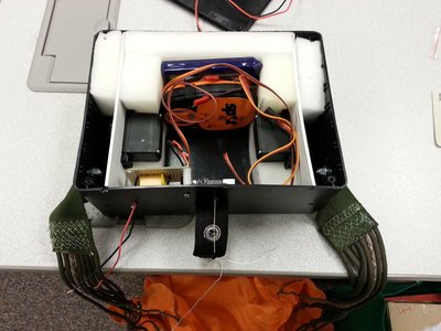
The HARP contains three main systems, the GPS tracking unit, a parachute control system, and a logging system. The GPS tracking unit reports its position over either a radio link or through a satellite connection. The serial output of the GPS is also read by the microcontroller, an ARM mbed LPC1768, which logs the data and parses it for control of the parachute. The microcontroller uses the information from the GPS to determine the optimal heading from the current position and the launch site adjusting the parachute control to guide the parachute.
Poster
Please log in to post comments.
