Teseo Location demo for GPSProvider using ST GNSS driver.
Dependencies: GPS_Provider X_NUCLEO_GNSS1A1
Getting Started with X-NUCLEO-GNSS1A1
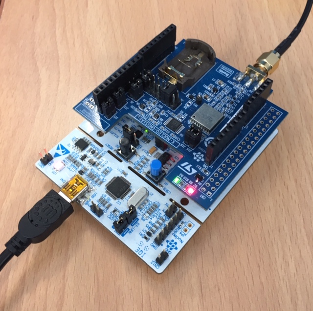
This example demonstrates how to use the X-NUCLEO-GNSS1A1 component with one of the STM32 Nucleo-64 platforms and how real time GNSS data received by the Teseo-LIV3F device can be displayed through a serial connection and a serial terminal on a PC. Furthermore the user can run commands enabling three advanced features:
- Geofencing
- Odometer
- Data Logging
Setup

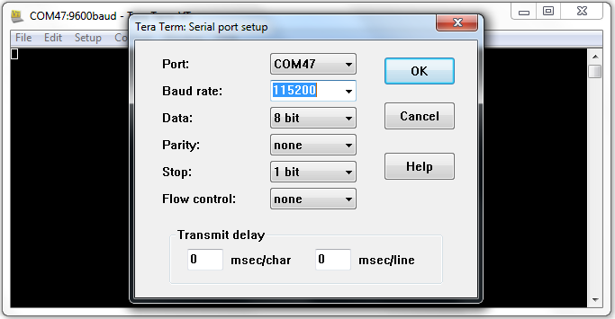
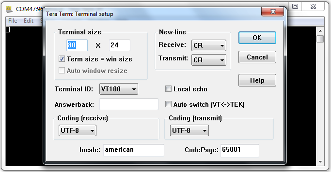
Once the antenna has been connected to the SMA female connector of the X-NUCLEO-GNSS1A1 plugged on top of the STM32 Nucleo, a serial connection should be set up between the STM32 Nucleo and the PC with the following parameters:
- baud rate: 115200
- data: 8 bit
- parity: none
- stop: 1bit
- flow control: none
- New-line (Tx/Rx): CR
Serial connection parameters


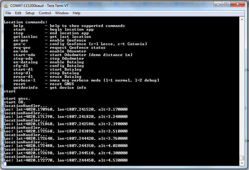
The user can select among different options to:
- get in a human readable format information related to the acquired GNSS position (or the satellites in view, the active satellites, and so on)
- enable feature (geofencing, odometer, data logging)
- configure a geofence circle
- require geofence status
- start/stop feature (odometer, data logging)
Application menu

Diff: source/geofence_config.h
- Revision:
- 0:7b0a5a01caec
--- /dev/null Thu Jan 01 00:00:00 1970 +0000
+++ b/source/geofence_config.h Fri Nov 09 17:10:46 2018 +0000
@@ -0,0 +1,64 @@
+/**
+ ******************************************************************************
+ * @file GPSGeofence.h
+ * @author AST/CL
+ * @version V1.1.0
+ * @date Oct, 2017
+ * @brief .
+ ******************************************************************************
+ * @attention
+ *
+ * <h2><center>© COPYRIGHT(c) 2017 STMicroelectronics</center></h2>
+ *
+ * Redistribution and use in source and binary forms, with or without modification,
+ * are permitted provided that the following conditions are met:
+ * 1. Redistributions of source code must retain the above copyright notice,
+ * this list of conditions and the following disclaimer.
+ * 2. Redistributions in binary form must reproduce the above copyright notice,
+ * this list of conditions and the following disclaimer in the documentation
+ * and/or other materials provided with the distribution.
+ * 3. Neither the name of STMicroelectronics nor the names of its contributors
+ * may be used to endorse or promote products derived from this software
+ * without specific prior written permission.
+ *
+ * THIS SOFTWARE IS PROVIDED BY THE COPYRIGHT HOLDERS AND CONTRIBUTORS "AS IS"
+ * AND ANY EXPRESS OR IMPLIED WARRANTIES, INCLUDING, BUT NOT LIMITED TO, THE
+ * IMPLIED WARRANTIES OF MERCHANTABILITY AND FITNESS FOR A PARTICULAR PURPOSE ARE
+ * DISCLAIMED. IN NO EVENT SHALL THE COPYRIGHT HOLDER OR CONTRIBUTORS BE LIABLE
+ * FOR ANY DIRECT, INDIRECT, INCIDENTAL, SPECIAL, EXEMPLARY, OR CONSEQUENTIAL
+ * DAMAGES (INCLUDING, BUT NOT LIMITED TO, PROCUREMENT OF SUBSTITUTE GOODS OR
+ * SERVICES; LOSS OF USE, DATA, OR PROFITS; OR BUSINESS INTERRUPTION) HOWEVER
+ * CAUSED AND ON ANY THEORY OF LIABILITY, WHETHER IN CONTRACT, STRICT LIABILITY,
+ * OR TORT (INCLUDING NEGLIGENCE OR OTHERWISE) ARISING IN ANY WAY OUT OF THE USE
+ * OF THIS SOFTWARE, EVEN IF ADVISED OF THE POSSIBILITY OF SUCH DAMAGE.
+ *
+ ******************************************************************************
+ */
+
+#ifndef __GPS_GEOFENCE_CFG_DATA_H__
+#define __GPS_GEOFENCE_CFG_DATA_H__
+
+typedef enum GeofenceId {
+ LecceId,
+ CataniaId
+} eGeofenceId;
+
+GPSGeofence::GeofenceCircle_t STLecce = {
+ .id = 5,
+ .enabled = 1,
+ .tolerance = 1,
+ .lat = 40.336055,
+ .lon = 18.120611,
+ .radius = 200
+ };
+
+GPSGeofence::GeofenceCircle_t Catania = {
+ .id = 6,
+ .enabled = 1,
+ .tolerance = 1,
+ .lat = 37.4908266,
+ .lon = 15.0073063,
+ .radius = 200
+};
+
+ #endif /* __GPS_GEOFENCE_CFG_DATA_H__ */
\ No newline at end of file
 X-NUCLEO-GNSS1A1 Global Navigation Satellite System